


भारत का भूगोल : भारत के द्वीप समूह (Geography of India : Islands of India)
हम भारत के द्वीप समूहों को दो भागों में वर्गीकृत कर सकते हैं :
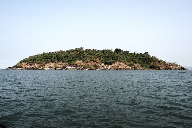
1. अंडमान निकोबार द्वीप समूह - यह द्वीप समूह 'बंगाल की खाड़ी' में स्थित है।
2. लक्षद्वीप समूह - यह 'अरब सागर' में स्थित है।
भारत के प्रमुख द्वीप एवं द्वीप समूह समूह समूह :
द्वीप समूह - अंडमान एवं निकोबार, लक्षद्वीप।
अन्य द्वीप - पंबन द्वीप, श्रीहरिकोटा, न्यू मूर द्वीप, अब्दुल कलाम द्वीप (व्हीलर द्वीप), नदी द्वीप (माजुली द्वीप)
We can classify the islands of India into two parts:
1. Andaman Nicobar Islands - This island is located in the 'Bay of Bengal' .
2. Lakshadweep Group - It is located in the 'Arabian Sea' .
Major islands and group of islands in India:
Islands - Andaman and Nicobar, Lakshadweep.
Other Islands - Pamban Island, Sriharikota, New Moore Island, Abdul Kalam Island (Wheeler Island), River Island (Majuli Island)
1.अंडमान एवं निकोबार द्वीप समूह : यह द्वीप समूह भारत से पूर्व दिशा में 'बंगाल की खाड़ी' में स्थित है। यह लगभग 5,72 छोटे बड़े दीपों के समूहों दीपों के समूहों से मिलकर बना है। मुख्यतया यह द्वीप समूह समुद्र में स्थित जलमग्न पर्वतों के हिस्से हैं। कुछ द्वीपों की उत्पत्ति 'ज्वालामुखी क्रिया' से भी जुड़ी हुई है। 10 अंश उत्तरी अक्षांश अंडमान द्वीप को निकोबार द्वीप से अलग करता है।
1. Andaman and Nicobar Islands: This island group is located in the east of India in the 'Bay of Bengal' . It is made up of groups of about 5,72 small and large lamps. These islands are mainly part of submerged mountains located in the sea. The origin of some islands is also associated with 'volcanic action' . 10 degrees North latitude separates Andaman Island from Nicobar Island.
अंडमान द्वीप समूह को चार भागों में वर्गीकृत किया जा सकता है :
1. उत्तरी अंडमान
2. मध्य अंडमान
3. दक्षिणी अंडमान
4. लिटिल अंडमान
The Andaman Islands can be classified into four parts:
1. North Andaman
2. Middle Andaman
3. South Andaman
4. Little Andaman
इस द्वीप समूह की प्रमुख चोटियाँ सैडल चोटी, माउंट डियोवोली, माउंट कोयोब और माउंट थुईल्लर है। दक्षिणी अंडमान में स्थित 'पोर्ट ब्लेयर' अंडमान एवं निकोबार द्वीप समूह की राजधानी की राजधानी है। यहाँ पर प्रसिद्ध 'सेल्यूलर जेल' स्थित है। 'कोको स्ट्रेट' अंडमान को म्यांमार के 'कोको द्वीप समूह' से अलग करती है। 'डंकन पास' दक्षिणी अंडमान तथा लिटिल अंडमान के बीच पाया जाता है। 'मध्य अंडमान' से पूर्व दिशा में 'बैरन द्वीप' है। यह भारत का एकमात्र 'सक्रिय ज्वालामुखी' है। उत्तरी अंडमान के पूर्व दिशा में स्थित 'नारकोंडम' एक 'सुषुप्त ज्वालामुखी द्वीप' का उदाहरण है।
The major peaks of this island are Saddle Peak, Mount Diovoli, Mount Koyob and Mount Thuiller . 'Port Blair' located in South Andaman is the capital of Andaman and Nicobar Islands. The famous 'Cellular Gel' is located here. 'Coco Strait' separates Andaman from Myanmar's 'Cocoa Islands' . 'Duncan Pass' is found between South Andaman and Little Andaman. East of 'Middle Andaman' is 'Baron Island' . It is the only 'active volcano' in India. An example is the 'Narcondam' an 'Suptu volcanic island' located in the east direction of North Andaman.
निकोबार द्वीप को भी तीन भागों में बाँटा जा सकता है :
1. कार निकोबार
2. लिटिल निकोबार
3. ग्रेट निकोबार
The island of Nicobar can also be divided into three parts:
1. Car Nicobar
2. Little Nicobar
3. Great Nicobar
6 डिग्री चैनल ग्रेट निकोबार को इंडोनेशिया के 'सुमात्रा द्वीप' से अलग करता है। ग्रेट निकोबार इंडोनेशिया के सुमात्रा द्वीप के सबसे निकट स्थित भारतीय क्षेत्र है। ग्रेट निकोबार के दक्षिण में भारत का सबसे दक्षिणतम बिंदु 'इंदिरा प्वाइंट' स्थित है। सन् 2004 में आई सुनामी के कारण यह जलमग्न हो चुका है। इंदिरा प्वाइंट को 'पिगमेलियन प्वाइंट' के नाम से भी जाना जाता है। अंडमान एवं निकोबार की सर्वोच्च चोटी 'सैडल पीक' है। यह उत्तरी अंडमान में स्थित है। इसके बाद 'माउंट थूलियर' अंडमान एवं निकोबार की दूसरी सबसे ऊंची चोटी है। यह ग्रेट निकोबार में स्थित है। अंडमान एवं निकोबार द्वीप समूह की प्रमुख जनजातियाँ शाँम्पेन, जारवा, सेंटिनलीज आदि हैं। ये सभी जनजातियाँ आज भी आदिम स्थिति में जीवन यापन कर रही हैं। वर्ष 2014 में 16वीं लोकसभा चुनाव में पहली बार शाँम्पेन जनजाति ने अपना मतदान किया था।
The 6 ° channel separates Great Nicobar from Indonesia's 'Sumatra Island' . Great Nicobar is the closest Indian territory to the island of Sumatra in Indonesia. To the south of Great Nicobar is India's southernmost point 'Indira Point' . It has been submerged due to tsunami in 2004 . Indira Point is also known as 'Pigmalion Point' . The highest peak of Andaman and Nicobar is 'Saddle Peak' . It is located in North Andaman. After this 'Mount Thulier' is the second highest peak of Andaman and Nicobar. It is located in Great Nicobar. The main tribes of Andaman and Nicobar Islands are Shampen, Jarwa, Sentinelies etc. All these tribes are still living in primitive condition. For the first time in the 16th Lok Sabha election in the year 2014 , the Shampen tribe cast their vote.
2. लक्षद्वीप समूह : लक्षद्वीप समूह भारत से पश्चिम में 'अरब सागर' में स्थित है। इस द्वीप का निर्माण 'प्रवाल भित्तियों' के द्वारा हुआ है। द्वीप समूह के कुल द्वीपों की संख्या 36 है। इनमें से भी केवल 10 ही आबाद हैं। लक्षद्वीप समूह की राजधानी का 'कवारत्ती' है। यह 9 अंश चैनल के उत्तर में स्थित है। 9 अंश चैनल, मिनिकॉय को लक्ष्यद्वीप के अन्य द्वीपों से अलग करता है। लक्ष्यद्वीप का सबसे बड़ा द्वीप मिनीकाँय है। 8 चैनल मिनिकॉय (लक्ष्यद्वीप) को मालदीव से अलग करता है।
2. Lakshadweep Group: The Lakshadweep group is located in the 'Arabian Sea' west of India. The island is formed by 'coral reefs' . The total number of islands in the islands is 36 . Of these, only 10 are inhabited. The capital of the Lakshadweep group is 'Kavaratti' . It is located north of the 9 fraction channel . The 9 degree channel separates Minicoy from other islands in the Lakshadweep island. Minicoy is the largest island in Lakshadweep. 8 channels separates Minicoy (Lakshadweep) from Maldives .
भारत के अन्य द्वीप समूह :
1. श्रीहरिकोटा -
Other Islands of India:
1. Sriharikota -
2. पंबन द्वीप - यह द्वीप आदम ब्रिज अथवा रामसेतु का ही एक भाग है तथा यह भारत तथा श्रीलंका के बीच अवस्थित है। पंबन द्वीप पर ही 'रामेश्वरम' स्थित है, जो तमिलनाडु का एक तीर्थ स्थल है। यह द्वीप 'मन्नार की खाड़ी' में स्थित है।
2. Pamban Island - This island is a part of the Adam Bridge or Ramsetu and is situated between India and Sri Lanka. On Pamban Island itself is located 'Rameswaram' , a pilgrimage site in Tamil Nadu. The island is located in the 'Gulf of Mannar' .
3. न्यू मूर द्वीप - यह द्वीप बंगाल की खाड़ी में अवस्थित है। यह भारत एवं बांग्लादेश की सीमा पर स्थित होने के कारण, अधिकार को लेकर दोनों देशों के बीच विवाद का एक कारण है। भारत के हिस्से में द्वीप समूह का जो भाग आया था, उसका अधिकांश भाग जलमग्न हो चुका है।
3. New Moore Island - This island is located in the Bay of Bengal. Being situated on the border of India and Bangladesh, there is a reason for dispute between the two countries over the right. Most of the part of the island group that came to India has been submerged.
4. व्हीलर द्वीप (अब्दुल कलाम द्वीप) - यह द्वीप समूह उड़ीसा की राजधानी भुवनेश्वर से लगभग 1,50 किलोमीटर की दूरी पर स्थित है। वर्तमान में इसे 'अब्दुल कलाम द्वीप' कहा जाता है। इसका पुराना नाम व्हीलर द्वीप था। इस द्वीप का प्रयोग भारत अपने प्रक्षेपास्त्र कार्यक्रम के परीक्षण केंद्र के रूप में करता है।
4. Wheeler Island (Abdul Kalam Island) - This island group is located at a distance of 1,50 km from Bhubaneswar, the capital of Orissa. Currently it is called 'Abdul Kalam Island' . Its old name was Wheeler Island . The island is used by India as a test center for its missile program.
5.माजुली द्वीप - यह द्वीप दुनिया का सबसे बड़ा नदी द्वीप है। यह द्वीप असम में ब्रह्मपुत्र नदी के मध्य बसा हुआ है। यहाँ की जनसंख्या सघन है तथा यह अपनी जैव विविधता के लिए पूरी दुनिया में प्रसिद्ध है। माजुली को असम का 33 वाँ जिला घोषित किया गया है। यह भारत का पहला नदी द्वीप जिला है।
5. Majuli Island - This island is the largest river island in the world. The island is situated between the Brahmaputra River in Assam. The population here is dense and it is famous all over the world for its biodiversity. Majuli has been declared the 33rd district of Assam. It is the first river island district of India.
RF competition
INFOSRF.COM
संबंधित जानकारी नीचे देखें।
(Watch related information below) 👇🏻

आशा है, उपरोक्त जानकारी उपयोगी एवं महत्वपूर्ण होगी।
(I hope the above information will be useful and important. )
Thank you.
लेखक
(Writer)
infosrf.com
पाठकों की टिप्पणियाॅं (0)
You may also like

National Mathematics Day - 22 December (राष्ट्रीय गणित दिवस) : श्रीनिवास रामानुजन की विरासत और गणितीय संकल्पना
महान गणितज्ञ रामानुजन का योगदान और गणित के अनछुए पहलू
Read more
गणित और ज्योतिष में 1 से 9 तक के अंकों का महत्व | 1 से 9 अंकों विश्लेषण, उपयोगिता और आध्यात्मिक महत्व की समन्वित प्रस्तुति
यह लेख अंक 1 से 9 तक के गणितीय महत्व के साथ-साथ उनके ज्योतिषीय और आध्यात्मिक पहलुओं का समग्र विश्लेषण प्रस्तुत करता है। प्रत्येक अंक की विशेषताओं को वैज्ञानिक एवं धार्मिक दृष्टिकोण से समझाते हुए, यह संख्याओं की बहुआयामी भूमिका को उजागर करता है।
Read more
इकाई, दहाई से लेकर शंख, दशशंख और ब्रह्मसंख्या (अनंत) तक की प्राचीन भारतीय गणना प्रणाली: विशाल संख्याओं की विलक्षण अवधारणा
भारत की प्राचीन गणनात्मक परंपरा में संख्याओं की अद्वितीय श्रेणी — जहाँ इकाई से शुरू होकर संख्याएं करोड़, खर्ब, नील, पद्म, शंख, दशशंख से होते हुए अनंत तक विस्तार पाती हैं, जो गणितीय चेतना और दार्शनिक गहराई को दर्शाती है।
Read more