


अक्षांश एवं देशान्तर रेखाएँ || Latitude and longitudinal lines
अक्षांश रेखाएँ - पृथ्वी के केंद्र से विषुवत् रेखा को आधार मानकर मापी गई कोणीय दूरी को 'अक्षांश' कहा जाता है। समान अक्षांशों को मिलाने वाली रेखा को 'अक्षांश रेखा' कहा जाता है। यह विषुवत रेखा के समानांतर खींची गई क्षैतिज रेखाएँ होती हैं। प्रति 1 डिग्री की अक्षांशीय दूरी लगभग 111 किलोमीटर होती है। पृथ्वी के प्रत्येक स्थान पर इसका मान एक जैसा नहीं होता। इसकी लंबाई में परिवर्तन होता रहता है।
अक्षांश रेखाएँ - पृथ्वी के केंद्र से विषुवत् रेखा को आधार मानकर मापी गई कोणीय दूरी को 'अक्षांश' कहा जाता है। समान अक्षांशों को मिलाने वाली रेखा को 'अक्षांश रेखा' कहा जाता है। यह विषुवत रेखा के समानांतर खींची गई क्षैतिज रेखाएँ होती हैं। प्रति 1 डिग्री की अक्षांशीय दूरी लगभग 111 किलोमीटर होती है। पृथ्वी के प्रत्येक स्थान पर इसका मान एक जैसा नहीं होता। इसकी लंबाई में परिवर्तन होता रहता है।
उदाहरण - विषुवत वृत्त पर इसकी लंबाई 110.6 किलोमीटर तथा ध्रुवों पर 111.7 किलोमीटर है। विषुवत रेखा से ध्रुवों की ओर जाने पर अक्षांशीय वृत्त की त्रिज्या में कमी आती जाती है। विषुवत रेखा से ध्रुवों की ओर जाने पर अक्षांश वृत्त की त्रिज्या में कमी आती जाती है। विषुवत रेखा से दुर्ग की ओर जाने पर अक्षांश रेखाओं का आकार क्रमशः कम होते जाता है और अंत में ये रेखाएँ उत्तरी एवं दक्षिणी ध्रुव पर बिंदु में परिवर्तित हो जाती हैं। दो अक्षांश रेखाओं के मध्य की दूरी को कटिबंध या जोन कहा जाता है। 90° अक्षांश रेखा को छोड़कर प्रत्येक अक्षांश रेखा एक संपूर्ण वृत होती है। विषुवत वृत्त के उत्तर की सभी अक्षांश रेखाओं को 'उत्तरी अक्षांश रेखाएँ' कहा जाता है। दक्षिण की सभी अक्षांश रेखाओं को 'दक्षिणी अक्षांश रेखाएँ' कहा जाता है। प्रत्येक अक्षांश के मान के साथ उसकी दिशा उत्तर अथवा दक्षिण लिखी जाती है। उदाहरण महाराष्ट्र में चंद्रपुर तथा दक्षिण अमेरिका के ब्राजील में बेलो हॉरिजॉन्टे दोनों ही 20° अक्षांश पर मिलते हैं। परंतु चंद्रपुर की स्थिति 20° उत्तरी अक्षांश एवं बेलो हॉरिजॉन्टे की स्थिति 20° दक्षिणी अक्षांश है।
Latitude lines - The angular distance measured from the center of the Earth as the equator is called 'latitude' . The line joining the same latitudes is called 'latitude line' . These are horizontal lines drawn parallel to the equator. The latitudinal distance per 1 degree is about 111 km . Its value is not the same at every place on the earth. Its length varies.
Example - It has a length of 110.6 kilometers on the equator and 111.7 kilometers at the poles. The radius of the latitudinal circle decreases as the equator moves from the equator to the poles. The radius of the latitude circle decreases as the equator moves from the equator to the poles. As the equator moves from the equator to the fort, the size of the latitudinal lines gradually decreases and finally these lines turn into points at the north and south poles. The distance between two latitude lines is called the tropics or zones . Each latitude line is a complete circle except the 90 ° latitude line. All latitude lines north of the equator are called 'northern latitude lines' . All south latitude lines are called 'southern latitude lines' . Each latitude has a value with its direction written north or south. Examples: Both Chandrapur in Maharashtra and Belo Horizonte in Brazil in South America are found at latitude 20 °. But Chandrapur's position is 20 ° northern latitude and Belo Horizonte's position is 20 ° southern latitude.
देशान्तर रेखाएँ -प्रधान याम्योत्तर रेखा के पूर्व अथवा पश्चिम में अवस्थित किसी स्थान की कोणीय दूरी 'देशांतर' कही जाती है। इस स्थान से गुजरने वाली तथा उत्तर और दक्षिणी ध्रुव को मिलाने वाली काल्पनिक रेखा 'देशांतर रेखा' कही जाती है। यह पृथ्वी को दो बराबर भागों में बाँटती है। देशान्तर रेखाओं को 'यामयोत्तर रेखाएँ' भी कहा जाता है। प्रत्येक देशांतर रेखा एक अर्धवृत्त होती है। देशांतर रेखाओं के मध्य की दूरी विषुवत रेखा पर सबसे अधिक होती है एवं ध्रुवों की ओर जाने पर कम होती जाती है। यह उत्तरी तथा दक्षिणी ध्रुव पर शून्य हो जाती है। यहाँ पर सभी देशान्तर रेखाएँ आपस में मिल जाती हैं।
Longitude lines - Angular distance of a place east or west of the main meridian line 'longitude' < / b> is called The imaginary line passing through this place and joining the north and south poles is called 'longitude line' . It divides the earth into two equal parts. The longitudinal lines are also called 'posterior lines' . Each longitude line is a semicircle . The distance between the longitude lines is the highest on the equator and decreases when going towards the poles. It becomes zero at the North and South Pole. All longitudinal lines are found here.
प्रधान याम्योत्तर – 0° देशांतर रेखा को प्रधान याम्योत्तर रेखा अथवा प्रधान मध्याह्नन रेखा कहा जाता है। इंग्लैंड के ग्रीनविच वेधशाला से होकर खींचे जाने की वजह से इसे ग्रीनविच रेखा भी कहा जाता है। समय की एकरूपता को ध्यान में रखते हुए विश्व के सभी देशों ने समय के आकलन के लिए ग्रीनविच रेखा को सर्वसम्मति से मानक समय देखा के रूप में स्वीकार कर लिया है. अतः इसे ग्रीनविच मानक समय रेखा भी कहा जाता है। भारत का समय ग्रीनविच से 5 घंटा 30 मिनट आगे रहता है। दो देशान्तर रेखाओं के मध्य की दूरी को गोर कहा जाता है। प्रधान याम्योत्तर के पश्चिम की दिशा देशान्तर रेखाओं को पश्चिमी देशान्तर रेखाएँ एवं पूर्व की सभी देशान्तर रेखाओं को पूर्वी देशांतर रेखाएँ कहा जाता है।
prime meridian - 0 ° longitude line to prime meridian or The main meridian line is called . It is also called the Greenwich Line because of England's pull through the Greenwich Observatory . Keeping in view the uniformity of time, all the countries of the world have unanimously accepted the Greenwich Line as the standard time for estimation of time. Therefore, it is also called the Greenwich Standard Time Line. India's time is 5 hours 30 minutes ahead of Greenwich. The distance between two longitudinal lines is called gore. The longitudinal lines to the west of the Prime Meridian are called the western longitudinal lines and all the longitudinal lines of the east are called the eastern longitude lines.
RF competition INFOSRF.COM
संबंधित जानकारी नीचे देखें।
(Watch related information below) 👇🏻

आशा है, उपरोक्त जानकारी उपयोगी एवं महत्वपूर्ण होगी।
(I hope the above information will be useful and important. )
Thank you.
लेखक
(Writer)
infosrf.com
पाठकों की टिप्पणियाॅं (0)
You may also like
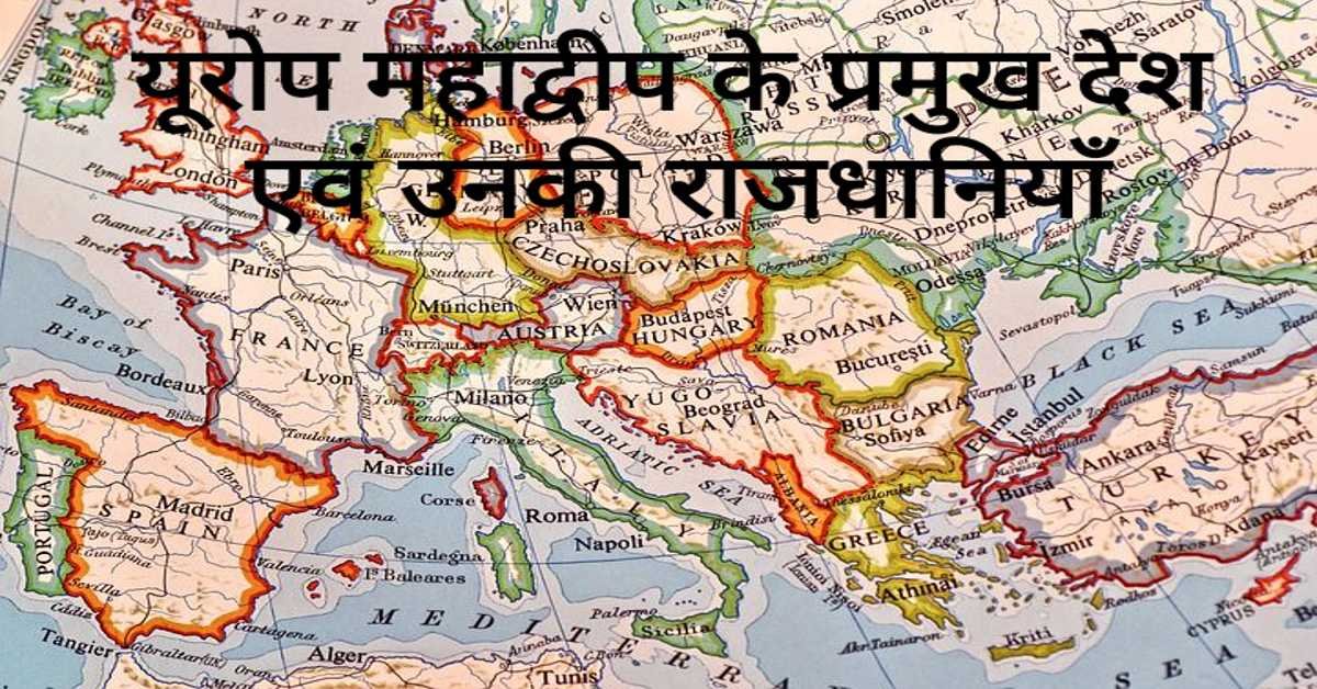
यूरोप महाद्वीप के प्रमुख देश एवं उनकी राजधानियाँ | Europe's Main Countries And Their Capitals
यहाँ यूरोप महाद्वीप के प्रमुख देश एवं उनकी राजधानियाँ दी गई हैं। Europe's Main Countries And Their Capitals given here.
Read more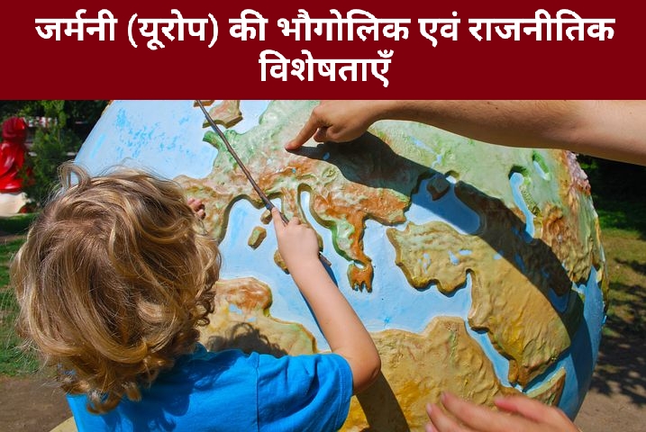
जर्मनी (यूरोप) की भौगोलिक एवं राजनीतिक विशेषताएँ | Geographical And Political Features Of Germany (Europe)
जर्मनी यूरोप महाद्वीप के महत्वपूर्ण देशों में से एक है। इसके उत्तर-पश्चिम में उत्तर सागर स्थित है। जर्मनी के उत्तर-पूर्व में बाल्टिक सागर स्थित है।
Read more.jpg)
फ्रांस (यूरोप) की भौगोलिक एवं राजनीतिक विशेषताएँ | Geographical And Political Features Of France (Europe)
फ्रांस क्षेत्रफल की दृष्टि से यूरोप महाद्वीप का दूसरा सबसे बड़ा देश है। यूरोप महाद्वीप का सबसे बड़ा देश रूस है।
Read more