


भारत का भूगोल : उत्तर भारत का विशाल मैदान Geography of India : Great Plain of Northern India
उत्तरी भारत के विशाल मैदान को 'गंगा, ब्रह्मपुत्र नदियों का मैदान' भी कहा जाता है। क्योंकि इस विशाल मैदान का निर्माण मुख्यतः सिंधु, गंगा एवं ब्रह्मपुत्र नदी तथा उनकी सहायक नदियों द्वारा लाए गए अवसादो के निक्षेपण के द्वारा हुआ है। यह मैदान पश्चिम दिशा में 'सिंधु नदी' से लेकर पूर्व दिशा में 'ब्रह्मपुत्र नदी' तक विस्तृत है। यह विशाल मैदान समतल है और इसके उच्चावच में अंतर बहुत कम है। यह मैदान पूर्व से पश्चिम तक लगभग 3,200 किलोमीटर लंबा है। इस मैदान की चौड़ाई लगभग 1,50 से 3,00 किलोमीटर है। यह मैदान समुद्र तल से लगभग 50 से 1,50 मीटर की ऊंचाई पर स्थित है। यह मैदान कृषि कार्य के लिए बहुत उपयुक्त है। क्योंकि यहां की मिट्टी उपजाऊ है तथा यहां पर उपयुक्त जलवायु है एवं पर्याप्त जलापूर्ति होती है।
The vast plains of northern India are also known as 'Ganges, the plains of the Brahmaputra rivers' . Because this vast plain is formed mainly by the deposition of sediments brought by the Indus, Ganga and Brahmaputra river and their tributaries. This plain extends from the 'Indus River' in the west to the 'Brahmaputra River' in the east. This vast plain is flat and the difference in its relief is very small. The plain is approximately 3,200 kilometers long from east to west. The width of this plain is approximately 1,50 to 3,00 km . This plain is situated at an altitude of 50 to 1,50 m above sea level. This field is very suitable for agricultural work. Because the soil here is fertile and has suitable climate and adequate water supply.
उतà¥à¤¤à¤° à¤à¤¾à¤°à¤¤ के विशाल मैदान को उचà¥à¤šà¤¾à¤µà¤š तथा à¤à¥Œà¤¤à¤¿à¤• लकà¥à¤·à¤£à¥‹à¤‚ के आधार पर पाà¤à¤š पà¥à¤°à¤¦à¥‡à¤¶à¥‹à¤‚ में विà¤à¤•à¥à¤¤ किया जा सकता है-
à¤à¤¾à¤¬à¤°, तराई, बांगर, खादर à¤à¤µà¤‚ डेलà¥à¤Ÿà¤¾à¥¤
The vast plain of North India can be divided into five regions on the basis of relief and physical characteristics -
Bhabar, Terai, Bangar, Khadar and Delta.
1. à¤à¤¾à¤¬à¤° : उतà¥à¤¤à¤°à¥€ à¤à¤¾à¤°à¤¤ में शिवालिक शà¥à¤°à¥‡à¤£à¤¿à¤¯à¥‹à¤‚ के गिरीपद पà¥à¤°à¤¦à¥‡à¤¶ में सिंधॠसे तीसà¥à¤¤à¤¾ नदी तक विसà¥à¤¤à¥ƒà¤¤ कà¥à¤·à¥‡à¤¤à¥à¤° को 'à¤à¤¾à¤¬à¤°' के नाम से जाना जाता है। यह à¤à¥‚à¤à¤¾à¤— हिमालय से निकली नदियों दà¥à¤µà¤¾à¤°à¤¾ लाठगठकंकड़, पतà¥à¤¥à¤°, बजरी आदि के के जमा होने के कारण बना है। इस मैदान की चौड़ाई 8 से 10 किलोमीटर है। इस मैदान में छोटी नदियां पतà¥à¤¥à¤°, बजरी, कंकड़ के ढेर के नीचे से पà¥à¤°à¤µà¤¾à¤¹à¤¿à¤¤ होती हैं। इस कारण ये नदियाठअदृशà¥à¤¯ हो जाती हैं। यह कà¥à¤·à¥‡à¤¤à¥à¤° कृषि कारà¥à¤¯ हेतॠउपयà¥à¤•à¥à¤¤ नहीं है। अतः यहां कृषि कम ही की जाती है।
1. Bhabar: covering a wide area from Indus to Teesta River in the Giripad Pradesh of Shivalik ranges in northern India. > Known as 'Bhabar' . This area is formed due to the accumulation of pebbles, stones, gravel etc. brought by the rivers originating from the Himalayas. The width of this ground is 8 to 10 km . In this plain, small rivers flow from beneath a pile of stone, gravel and pebbles. Due to this, these rivers become invisible. This area is not suitable for agricultural work. Hence agriculture is rarely done here.
2. तराई : यह मैदान à¤à¤¾à¤¬à¤° पà¥à¤°à¤¦à¥‡à¤¶ से दकà¥à¤·à¤¿à¤£ दिशा में सà¥à¤¥à¤¿à¤¤ है। यह à¤à¤• दलदली कà¥à¤·à¥‡à¤¤à¥à¤° है और बारीक पतà¥à¤¥à¤°, कंकड़, चिकनी मिटà¥à¤Ÿà¥€ तथा रेत आदि से बना हà¥à¤† है। इसकी चौड़ाई 10 से 20 किलोमीटर है। à¤à¤¾à¤¬à¤° पà¥à¤°à¤¦à¥‡à¤¶ में जो नदियाठअदृशà¥à¤¯ हो जाती हैं। वे सà¤à¥€ तराई कà¥à¤·à¥‡à¤¤à¥à¤° में आकर पà¥à¤¨à¤ƒ दृशà¥à¤¯ मान हो जाती हैं। तराई कà¥à¤·à¥‡à¤¤à¥à¤° का पशà¥à¤šà¤¿à¤® की अपेकà¥à¤·à¤¾ पूरà¥à¤µ में अधिक विसà¥à¤¤à¤¾à¤° हैं। इसका कारण पूरà¥à¤µ में वरà¥à¤·à¤¾ की अधिकता का होना है। इस कà¥à¤·à¥‡à¤¤à¥à¤° में पानी बिखरा हà¥à¤† रहता है, कà¥à¤¯à¥‹à¤‚कि यहाठढाल की कमी है। अतः यह à¤à¥‚मि कà¥à¤·à¥‡à¤¤à¥à¤° सदैव नाम बना रहता है à¤à¤µà¤‚ कृषि कारà¥à¤¯ हेतॠउपयà¥à¤•à¥à¤¤ है। यहाठमà¥à¤–à¥à¤¯à¤¤à¤ƒ चावल, गेहूà¤, गनà¥à¤¨à¤¾ आदि की फसलें उगाई जाती हैं।
2. Terai: This plain is located in the south direction from Bhabar Pradesh. It is a marshy area and is made of fine stones, pebbles, clay and sand etc. Its width is 10 to 20 kilometers . The rivers which become invisible in Bhabar Pradesh. They all return to the Terai region and become visible again. The Terai region is more extended in the east than in the west. The reason for this is the excess rainfall in the east. Water remains scattered in this area, because there is a lack of slope here. Therefore, this land area always remains the name and is suitable for agricultural work. Here crops of rice, wheat, sugarcane etc. are grown.
3. बांगर : बांगर à¤à¥‚मि कà¥à¤·à¥‡à¤¤à¥à¤° पà¥à¤°à¤¾à¤¨à¥€ जलोढ़ मिटà¥à¤Ÿà¥€ से निरà¥à¤®à¤¿à¤¤ है। यह उतà¥à¤¤à¤°à¥€ मैदान की उचà¥à¤š à¤à¥‚मि है। उतà¥à¤¤à¤° à¤à¤¾à¤°à¤¤ के मैदान का सबसे विशालतम à¤à¤¾à¤— पà¥à¤°à¤¾à¤¨à¥‡ जलोढ़ का बना हà¥à¤† है जिसे 'बांगर' कहा जाता है। इस कà¥à¤·à¥‡à¤¤à¥à¤° का विसà¥à¤¤à¤¾à¤° मà¥à¤–à¥à¤¯ रूप से उतà¥à¤¤à¤° पà¥à¤°à¤¦à¥‡à¤¶ तथा पंजाब के मैदानी à¤à¤¾à¤—ों में है। इस कà¥à¤·à¥‡à¤¤à¥à¤° में कंकड़ à¤à¥€ पाठजाते हैं। शà¥à¤·à¥à¤• कà¥à¤·à¥‡à¤¤à¥à¤°à¥‹à¤‚ में इन मैदानों में कà¥à¤·à¤¾à¤°à¥€à¤¯ उतà¥à¤«à¥‚लन देखे जाते हैं, जिनà¥à¤¹à¥‡à¤‚ 'रेह' या 'कलà¥à¤²à¤°' à¤à¥€ कहा जाता है। इन मैदानों में नदियों के बा काॠजल नहीं पहà¥à¤à¤š पाता है, कà¥à¤¯à¥‹à¤‚कि यह सà¤à¥€ कà¥à¤·à¥‡à¤¤à¥à¤° नदियों के बाढ़ वाले मैदान के तल से ऊपर सà¥à¤¥à¤¿à¤¤ है। यह कà¥à¤·à¥‡à¤¤à¥à¤° कृषि हेतॠकम उपयोगी है तथा यहां à¤à¥‚मिगत जल सà¥à¤¤à¤° की गहराई अधिक है। बांगर पà¥à¤°à¤¦à¥‡à¤¶ में अपकà¥à¤·à¤¯ के कारण à¤à¥‚मि के ऊपर की मà¥à¤²à¤¾à¤¯à¤® मिटà¥à¤Ÿà¥€ नषà¥à¤Ÿ हो गई है और उसके सà¥à¤¥à¤¾à¤¨ पर अब वहाठकंकरीली à¤à¥‚मि मिलती है। इस पà¥à¤°à¤•à¤¾à¤° की à¤à¥‚मि को 'à¤à¥‚ड़' कहा जाता है।
3. Bangar: Bangar land area is formed from old alluvial soil. It is the high ground of the northern plain. The largest part of the plain of North India is made up of old alluvium called 'Bangar' . This area is mainly spread in the plains of Uttar Pradesh and Punjab. Pebbles are also found in this area. Alkaline eruptions are seen in these plains in dry areas, also known as 'reh' or 'culler' . In these plains, the flood water cannot reach the rivers, because all these areas are located above the bottom of the floodplain of the rivers. This area is less useful for agriculture and the depth of ground water level is higher here. In Bangar Pradesh , due to weathering, the soft soil above the ground has been destroyed and in its place now there is muddy land. This type of land is called 'Bhud' .
4. खादर : 'खादर' नवीन जलोढ़ मिटà¥à¤Ÿà¥€ दà¥à¤µà¤¾à¤°à¤¾ निरà¥à¤®à¤¿à¤¤ है। यह उतà¥à¤¤à¤° à¤à¤¾à¤°à¤¤ के मैदानों की निचली à¤à¥‚मि है। इस à¤à¥‚मि का विसà¥à¤¤à¤¾à¤° बिहार, पशà¥à¤šà¤¿à¤® बंगाल à¤à¤µà¤‚ पूरà¥à¤µà¥€ उतà¥à¤¤à¤° पà¥à¤°à¤¦à¥‡à¤¶ तक है। इसमें 'काà¤à¤ª मिटà¥à¤Ÿà¥€' à¤à¥€ पाई जाती है। खादर पà¥à¤°à¤¦à¥‡à¤¶ नदियों के निचले हिसà¥à¤¸à¥‡ पर सà¥à¤¥à¤¿à¤¤ है। इस कà¥à¤·à¥‡à¤¤à¥à¤° में बाढ़ के समय जलोढ़ की नई परत बन जाती है। इस कà¥à¤·à¥‡à¤¤à¥à¤° का à¤à¥‚मिगत जल सà¥à¤¤à¤° काफी ऊंचा है। अतः यह कà¥à¤·à¥‡à¤¤à¥à¤° कृषि कारà¥à¤¯ हेतॠबहà¥à¤¤ उपयà¥à¤•à¥à¤¤ है। यहाठकी मिटà¥à¤Ÿà¥€ बहà¥à¤¤ उपजाऊ है। खादर à¤à¥‚मि कà¥à¤·à¥‡à¤¤à¥à¤° में मृदा में 'चीका' की अधिकता है। यह चीका à¤à¥‚मि को नमी धारण करने की कà¥à¤·à¤®à¤¤à¤¾ पà¥à¤°à¤¦à¤¾à¤¨ करती है। इस कà¥à¤·à¥‡à¤¤à¥à¤° की पà¥à¤°à¤®à¥à¤– फसलें जूट, गनà¥à¤¨à¤¾, दलहन, तिलहन, चावल, गेहूं आदि है।
4. Khadar: 'Khadar' is produced by new alluvial soil. It is the lowland of the plains of North India. This land extends to Bihar, West Bengal and eastern Uttar Pradesh. In this 'tremor soil' is also found. The Khadar region is situated on the lower part of the rivers. In this area, a new layer of alluvial is formed at the time of flood. The underground water level of this region is quite high. Therefore, this area is very suitable for agricultural work. The soil here is very fertile. Soil in the Khadar Land Area has an excess of ' cheeka' . This cheek provides the soil with the ability to absorb moisture. The major crops of the region are jute, sugarcane, pulses, oilseeds, rice, wheat etc.
5. डेलà¥à¤Ÿà¤¾ : खादर के मैदान के बढ़े हà¥à¤ à¤à¤¾à¤— को 'डेलà¥à¤Ÿà¤¾' कहा जाता है। इस à¤à¥‚मि का विसà¥à¤¤à¤¾à¤° निचली गंगा घाटी में पाया जाता है। यह निचली गंगा घाटी पशà¥à¤šà¤¿à¤® बंगाल में सà¥à¤¥à¤¿à¤¤ है। डेलà¥à¤Ÿà¤¾ कà¥à¤·à¥‡à¤¤à¥à¤° में पà¥à¤°à¤¾à¤¨à¤¾ व नया पंक समà¥à¤®à¤¿à¤²à¤¿à¤¤ है। इसके अंतरà¥à¤—त दलदल à¤à¥€ आता है। डेलà¥à¤Ÿà¤¾ कà¥à¤·à¥‡à¤¤à¥à¤° की à¤à¥‚मि को 'चार' कहा जाता है।
5. Delta: The enlarged part of the Khadar plain is called 'Delta' . The extension of this land is found in the lower Ganges valley. It is located in the lower Ganges valley of West Bengal. The delta region includes old and new punk . It also comes under Swamp . The land in the delta region is called 'Char' .
RF competition
INFOSRF.COM
संबंधित जानकारी नीचे देखें।
(Watch related information below) 👇🏻

आशा है, उपरोक्त जानकारी उपयोगी एवं महत्वपूर्ण होगी।
(I hope the above information will be useful and important. )
Thank you.
लेखक
(Writer)
infosrf.com
पाठकों की टिप्पणियाॅं (0)
You may also like
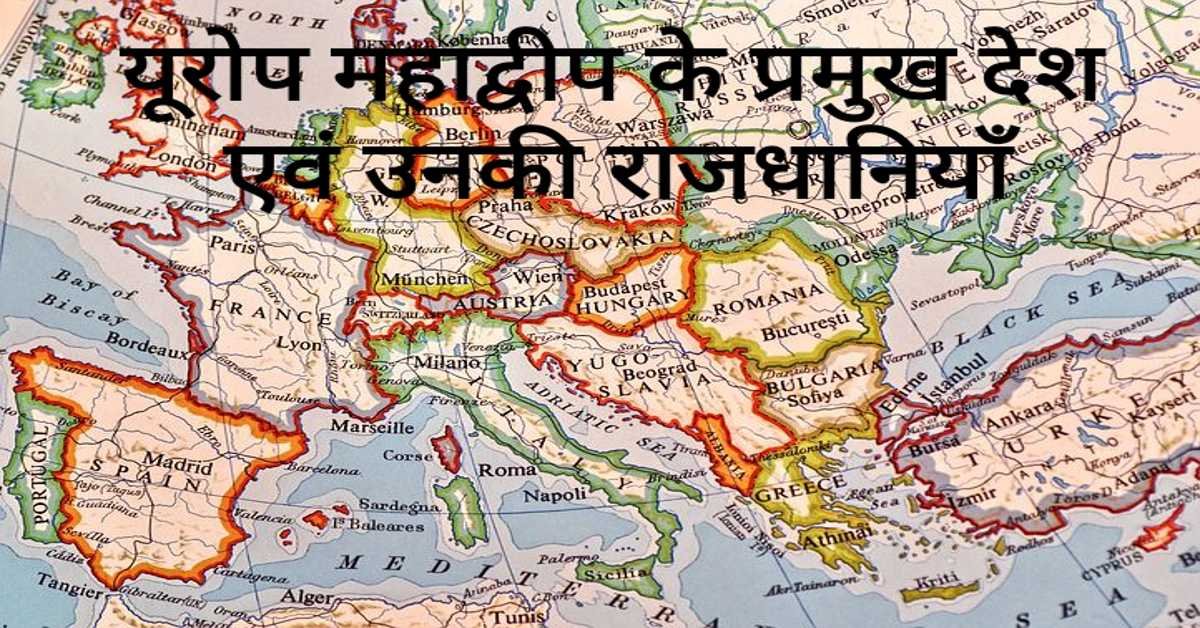
यूरोप महाद्वीप के प्रमुख देश एवं उनकी राजधानियाँ | Europe's Main Countries And Their Capitals
यहाँ यूरोप महाद्वीप के प्रमुख देश एवं उनकी राजधानियाँ दी गई हैं। Europe's Main Countries And Their Capitals given here.
Read more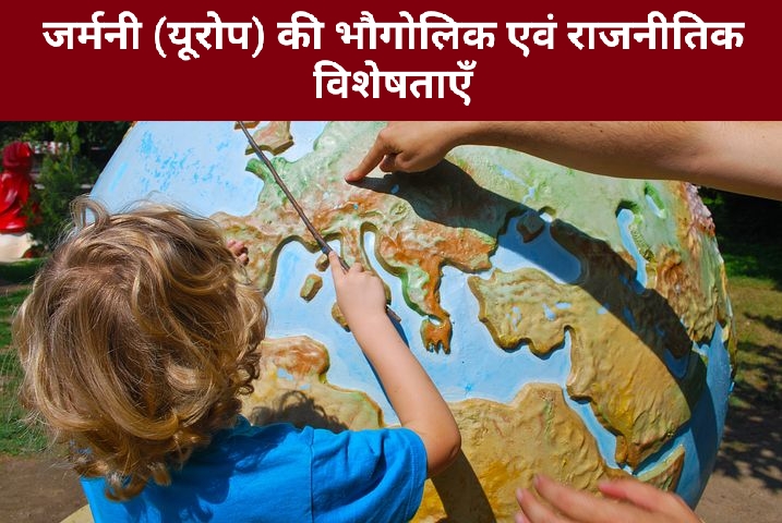
जर्मनी (यूरोप) की भौगोलिक एवं राजनीतिक विशेषताएँ | Geographical And Political Features Of Germany (Europe)
जर्मनी यूरोप महाद्वीप के महत्वपूर्ण देशों में से एक है। इसके उत्तर-पश्चिम में उत्तर सागर स्थित है। जर्मनी के उत्तर-पूर्व में बाल्टिक सागर स्थित है।
Read more.jpg)
फ्रांस (यूरोप) की भौगोलिक एवं राजनीतिक विशेषताएँ | Geographical And Political Features Of France (Europe)
फ्रांस क्षेत्रफल की दृष्टि से यूरोप महाद्वीप का दूसरा सबसे बड़ा देश है। यूरोप महाद्वीप का सबसे बड़ा देश रूस है।
Read more